Our Services
- Geocoding
Services - 3D Visualization
Modelling - RF Maps
Land Use Maps - Agri GIS
. - HR Consulting
Services - Services for Construction
Industry - 3D
Modelling - Spatial Tools for
Farm Management
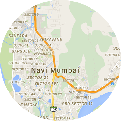
For planning business activities based on a particular location, it becomes necessary to use a technology that can map geographic areas and facilitate integrating business data to those location mappings. Through this, a lot of business information and statistics can be presented on maps, which can present a more easily decipherable picture of the information under analysis.
Through geocoding services, Geomarks assigns coordinates to businesses and customer concentrations from its database using GIS tools, which gives businesses a fair idea about trends and distributions in a particular aspect, product or services in respective locations. Geocoding activities are taken up by implementing:
- Survey Method
- Automated Geocoding using GIS tools
- Semi Automatic Geocoding service
The geocoding activity helps in locating the customers for the business across regions. Studies in common patterns of product demand and acceptance integrated to geographical area mapping can give easily comprehendible information. This can in turn lead to having good real time, on the ground insight which in turn can lead to apt business strategies and decisions. Geomarks can bring this about in a short time, benefitting businesses immensely.
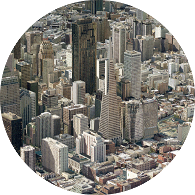
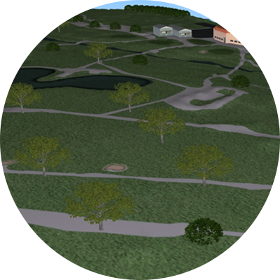
Adding up to basic geographical analysis and mapping, leading to visual representation of business information under analysis, 3D visualization technology is implemented by Geomarks for businesses to get a real world view on the projected proposals and plans to be implemented in a location of interest. So if a client can be shown a 3D virtual model of a new building project under consideration in a particular location, the pros and cons and the level of feasibility and benefit from the implementation can be easily communicated and understood.
The integration of 3D technology into such vital business planning adds immense value to the exercise. Geomarks brings this technology to its client businesses to make good of advanced technology in geolocation to present scenarios and projections in a far better and realistic way.
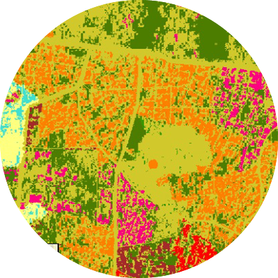
A method of locating places on a geolocating system, RF mapping does geolocating with the help of radio/mobile tower frequencies to pinpoint people. Very effective method in mobile devices, its use in business applications goes where the customer reach is actuated via mobile devices. The use of this method to generate geolocation maps may work less accurately compared to GPS systems, based on satellite. But the everyday improvements is making it perform better and more accurately.
Geomarks provide high resolution RF Maps of 2.5 meters, 5 meters, 15 Meters, 20 Meters and 30 meters resolution with as many as 22 classes for wireless network planning, RF planning, RF network planning and optimization. The system has impressive features viz.
- Customizable, modular and scalable layers:
- Clutter Maps
- Digital Elevation Model (DEM)
- Vector Maps
- GeoCoded Places
- Satellite and Aerial Orthorectified Imagery
- Fully compatible with all major RF planning tools like Aircom, NetAct, TEMS, Planet, MapInfo/Vertical Mapper , Celplan, Forsk Atoll, etc.
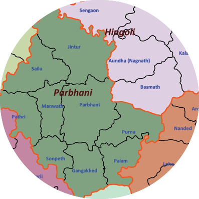
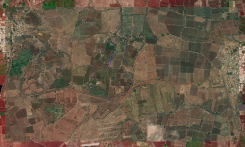
Our Agriculture map data products are designed for organisations and users for their sales and distributions strategies based on various factors. The combination of location, census and agricultural information makes these maps a powerful tool for the users looking for making location based intelligent decisions. Using our GIS map data you can position the right kind of product for the right region and with help of the attached census data you can strategise your sales and distribution network. It is utilized across all industries for Business/Sales Planning, Channel Management, Customer Relationship Management, Demographic Analysis, and Geocoding / Reverse Geocoding applications, etc.
Our Map data consits of
- Village Boundaries
- Tehsil/Block Boundaries
- District Boundaries
- State Boundaries
The Map data comes with the following attributes
- Populations as per Census 2011
- Average annual Rainfall
- Average Rainy Days
- River Basin
- Soil Cover
- Cropping intensity
- Cropping pattern
- Agro Climatic region
- Ground water availability
- Hydrology
- Land holdings pattern
- Crop coverage major crops
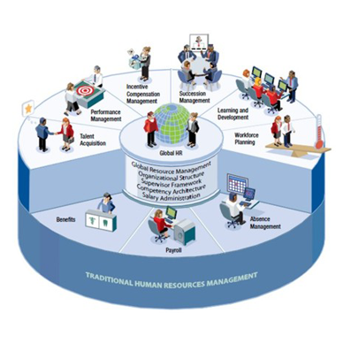
To meet the increasing demand for skilled man power, Geomarks has the capabilities to help organizations in finding manpower suiting their requirements.
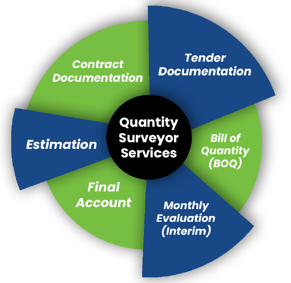
- Quantity Surveying Services
- PMC services - Construction scheduling and tracking
- Structural design services - STAAD/E-TABS
- Architectural Consultancy services - Plans & Elevations (including 3D models)
- Valuation Services for property
Quantity Surveying Services
As an Outsourcing QS service provider we recognize deficiencies in project documentation and contribute significantly to mitigate major problems by way of conflicting, impractical, unclear, missing, late or incorrect information.
Preparation of BoQ, as per POMI, SMM 7. All the BoQ’s are tailored as per the client’s need.
Our business model is similar to well proven and hugely successful outsourcing model in IT industry worldwide.
Advantages working with us:
- The main reason behind competitive pricing is we are based in India and we do outsourcing works for our clients worldwide. Our pricing is very economical to our clients when compared to our competitors who are based in the same country as our clients.
- Though Outsourcing model is established in construction industry, the distinct advantage we have is the Human Resource availability and the running costs we spent on our professional work force is far less when compared to our competitors.
- To achieve the high quality standards we have formulated a structure which involves a series of checks at various levels before submitting the work to the clients. Internal Deadlines will be given to each project keeping in mind the clients deadline for submission. This will reduce and minimize the errors and hence increases the accuracy and quality in our work.
- Our professionals are well versed with the pricing of the BoQ for U.K Projects.
- Our professionals are well versed with all the software tools used for quantity take off’s such as Blue Beam Revu, Auto CAD, Planswift, PDF measurements.
As outsourcing QS Consultants we not only measure & valuate material quantities but check back with design specification in order to measure accurately and thus adding value to the customers
Construction scheduling and tracking
- Preparation of project schedules at various stages using MSP/ Primavera, and revision of baselines. Identifying the activities in critical path & listing of the long- lead items.
- Generating reports/ Dash boards, and preparing weekly/monthly progress presentations in ppt.
- We outsource a construction management professional to join your team for meetings and presentations.
Structural design services - STAAD/E-TABS
- Our professionals strive to provide you with comprehensive information on the best choice of reinforced cement concrete, composite and steel elements to be used for construction. Be it high-rise residential buildings, skyscrapers housing work places or industrial structures such as plants and refineries, we have you covered.
- Our services help you in the building of structures that resist gravity and lateral loads. We model the structures prior to construction and provide you with the extensive impact and subsequent green flag to proceed with the final construction.
- High-rise buildings with seismic analysis and wind analysis.
- We are experts in the following:
- Commercial buildings with beam- slab, Flat slab & PT slab system.
- All RCC designs of residence, hotels, high rise buildings & commercial projects.
Architectural Consultancy services - Plans & Elevations (including 3D models)
- We extensively have a talented pool of human resource who have attained mastery over different tools that are used to present the plans and elevations.
- We offer 2D plans, 3D plans & Elevations.
Valuation Services for property
- Our Certified valuation experts had a good command of the market in Telangana and Andhra Pradesh regions.
- We offer the valuation services that are accepted by various nationalized banks to offer the loans against property.
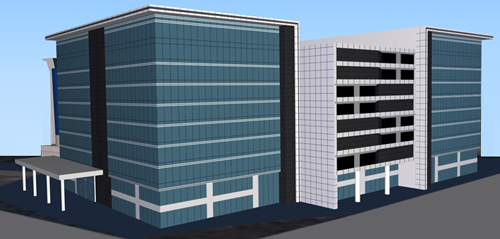
3D landmarks are digital 3D models of buildings like places of Famous historical monuments, worship, towers, and other important buildings.
Creating 3Dimentional view for Landmarks is very important, and they are well known features determining the scenery of a city or a landscape.
3D landmarks are significantly used in tourism, navigation system, urban planning, real estate etc...
The concept of 3D landmarks is gaining popularity as Points of Interest (POI) in navigation applications such as vehicle navigation systems, digital city guides and mobile applications for city travel.
3D Building Landmarks are created with precisely geocoded real time 3D replica of landmarks in a city.
Light model of 3D Landmarks will be created in such way as to provide the best view on the screen of a portable device or a mobile phone. The data creation process is different with lesser polygon counts and lighter in file size making it easy to load and view on a mobile phones.
After creating model with minimum required faces, will be textured those using aerial images and on-ground photographs to provide a realistic feel
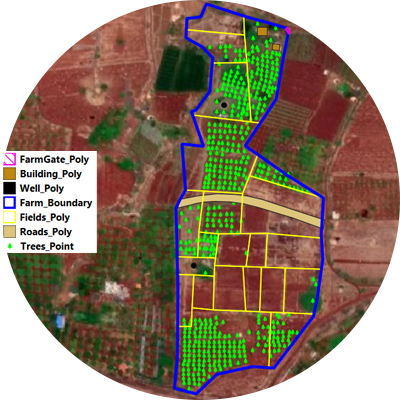
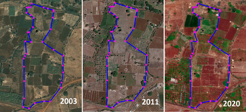
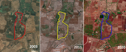
Manage Your Farm Boundary
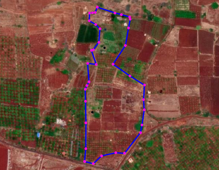
Get the historical glimpse of your area and surrounding area using Historical images to
- Know the historical cropping patterns
- Know what is going around your area.
- Assess Current Commercial value of your farm
Get the historical glimpse of your area and surrounding area using History images to
- Know the historical cropping patterns and Land use
- Know what is going around your area.
- Know the commercial value of your farm
Map all your assets within farm to keep updated about inventory of assets like
- Wells
- Water tanks
- water pipe lines
- Fence Compound walls
- Roads
- Rain water Drainage Network
- Get the exact tree cover and vegetation
In case of Plantations
- keep track of all species and varieties that you own
- Know the exact canopy cover to
- Plan inter crops
- estimate Water, Fertilizers, pesticide requirement
Plan the soil water conservation
- Construct bunds using terrain and soil data
- Construct water conservation ponds using terrain Data